
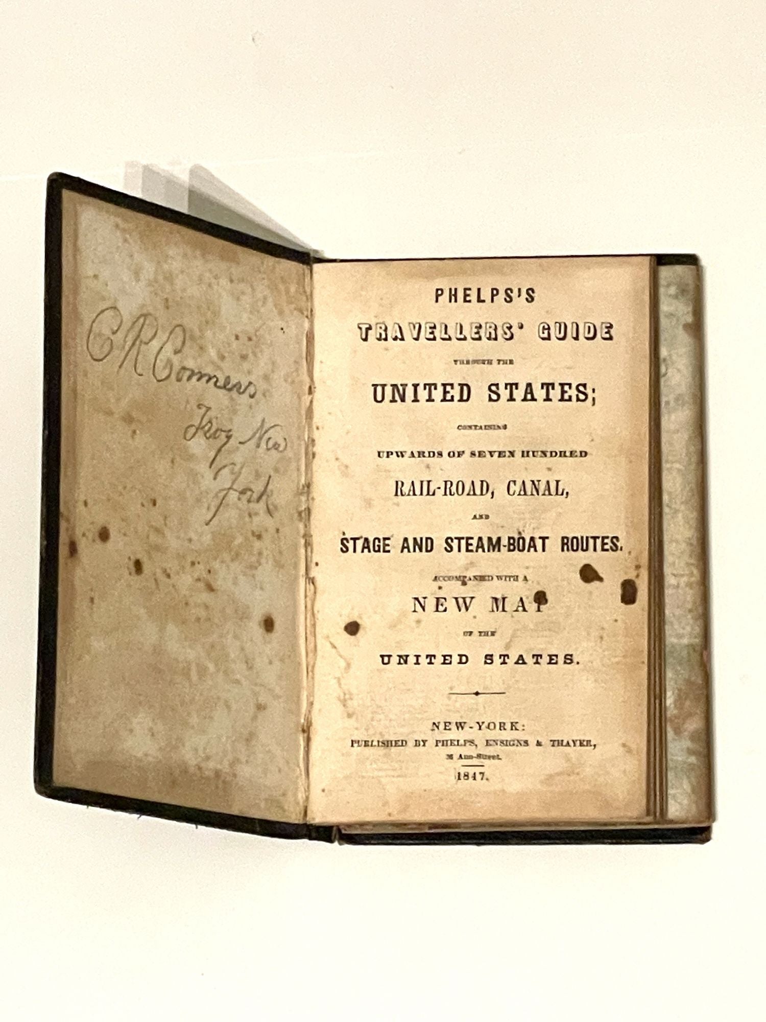
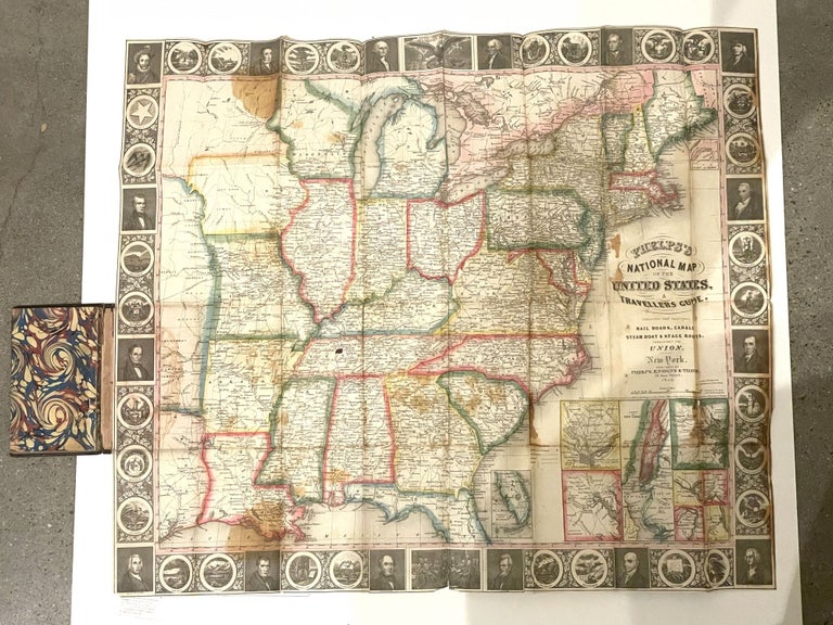
Phelps's National Map of the United States, A Travellers Guide. Embracing the Principal Rail Roads, Canals, Steam Boat & Stage Routes, Throughout the Union
1847. Item #8
Phelps's National Map of the United States, A Travellers Guide. Embracing the Principal Rail Roads, Canals, Steam Boat & Stage Routes, Throughout the Union, 1847. 14 x 9 cm. Full black calf and gilt, some light rubbing, few small stains to title page, some stains to map. Rear board DETACHED with map at hinge. Generally, an attractive copy.
The 1847 issue has a completely re-engraved map that extends to the Great Plains and includes part of Texas with two large unnamed regions extending northward, presumably the Indian territories and western Wisconsin Territory. It is accented on the periphery by alternating state seals and important historical figures. Increasingly scarce in commerce, especially in good condition. The text itself delineates seven hundred railroad routes and captures the unbelievably brisk territorial expansion and development of the country as it approached the mid 19th century. Ref: Howes #P-291.
Price: $1,200.00